TOWN OF Chebeague Island
SUBDIVISION ORDINANCE
SECTION 1. PURPOSE
1.1 The
purpose of these standards shall be to assure the comfort, convenience, safety,
health and welfare of the people, to protect the environment and to promote the
development of an economically sound and stable community. To this end, in approving subdivisions
within the Town of Chebeague Island, Maine, the Planning Board shall consider
the following criteria and before granting approval shall determine that the
proposed subdivision:
1. Pollution. The proposed subdivision will
not result in undue water or air pollution. In making this determination, it shall at least consider:
A. The
elevation of the land above sea level and its relation to the flood plains;
B. The
nature of soils and subsoils and their ability to adequately support waste disposal;
C. The
slope of the land and its effect on effluents;
D. The
applicable state and local health and water resource rules and regulations;
2. Sufficient
water. The proposed subdivision has
sufficient water available for the reasonably foreseeable needs of the
subdivision;
3. Municipal
water supply. The
proposed subdivision will not cause an unreasonable burden on an existing water
supply, if one is to be used;
4. Erosion. The proposed subdivision will
not cause unreasonable soil erosion or a reduction in the land's capacity to
hold water so that a dangerous or unhealthy condition results;
5. Traffic. The proposed
subdivision will not cause unreasonable highway or public road congestion or
unsafe conditions with respect to the use of the highways or public roads
existing or proposed;
6. Sewage
disposal. The proposed subdivision
will provide for adequate sewage waste disposal.
7. Municipal
solid waste disposal. The
proposed subdivision will not cause an unreasonable burden on the
municipality’s ability to dispose of solid waste, if municipal services are to
be utilized;
8. Aesthetic,
cultural and natural values. The
proposed subdivision will not have an undue adverse effect on the scenic or
natural beauty of the area, aesthetics, historic sites, significant wildlife
habitat identified by the Department of inland Fisheries and Wildlife or the
municipality, or rare and irreplaceable natural areas or any public rights for
physical or visual access to the shoreline;
9. Conformity
with local ordinances and plans. The
proposed subdivision conforms with a duly adopted subdivision regulation or
ordinance, comprehensive plan, development plan or land use plan, if any. In making this determination, the
municipal reviewing authority may interpret these ordinances and plans;
10. Financial
and technical capacity. The
subdivider has adequate financial and technical capacity to meet the standards
of this section;
11. Surface
waters;. Whenever
situated within 250 feet, horizontal distance, of any wetland as defined in Title 38, Maine Revised Statutes,
Ch. 3, SubCh. I, Art. 2-B,
the proposed subdivision will not adversely affect the quality of that body of
water or unreasonably affect the shoreline of the body of water;
12. Ground
water. The proposed subdivision will
not, alone or in conjunction with existing activities, adversely affect the
quality or quantity of ground water;
13. Flood
areas. Based on the
Federal Emergency Management Agency's Flood Boundary and Floodway Maps and
Flood Insurance Rate Maps, and information presented by the applicant whether
the subdivision is in a flood-prone area.
If the subdivision, or any part of it, is in such an area, the
subdivider shall determine the 100-year flood elevation and flood hazard
boundaries within the subdivision.
The proposed subdivision plan must include a condition of plan approval
requiring that principal structures in the subdivision will be constructed with
their lowest floor, including the basement, at least one foot above the
100-year flood elevation;
14. Storm
water. The proposed
subdivision will provide for adequate storm water management;
15. Freshwater
wetlands. All potential
freshwater wetlands, as defined in 30-A M.R.S. § 4401(2-A), within the
proposed subdivision have been identified on any maps submitted as part of the
application, regardless of the size of these wetlands. Any mapping of freshwater wetlands may
be done with the help of the local soil and water conservation district; and
16. River,
stream or brook. Any
river, stream, or brook within or abutting the proposed subdivision has been
identified on any map submitted as a part of the application. For purposes of this section,
"river, stream or brook" has the same meaning as in Title 38, Maine
Revised Statutes, Sec. 480-B, Subsec. 9, as amended.
SECTION
2 AUTHORITY AND ADMINISTRATION
2.1 AUTHORITY
A. This
Ordinance has been prepared in accordance with the provisions of Title 30-A
M.R.S. §§ 4401 et seq.
B. These
standards shall be known and may be cited as "Town of Chebeague Island
Subdivision Ordinance."
2.2 ADMINISTRATION
A. The
Planning Board of the Town of Chebeague Island, hereinafter called the Board,
shall administer this Ordinance.
B. The
provisions of this Ordinance shall pertain to all the land proposed for
subdivision as herein defined within the boundaries of the Town of Chebeague
Island .
SECTION
3 DEFINITIONS
3.1 In general, words and
terms used in these standards shall have their customary dictionary
meanings. More specifically,
certain words and terms used herein are defined as follows:
A. Byway:
A traffic way alongside or adjacent to one side
of the paved portions of roads to be used by persons including, but not limited
to, pedestrians, bicyclists, and handicapped persons operating motorized
wheelchairs and which otherwise specifically excludes motorized vehicles,
except as otherwise provided in this Ordinance or State law. Byways include sidewalks, freewalks and
paved shoulders.
B. Clustered
Residential Development or Subdivision:
A
type of development where building lots are smaller with lot frontages that are
shorter than those in a traditional subdivision, are grouped on certain
portions of the site that are best suited for development, and other areas
remain open and free from development.
The homes may or may not be connected to the public sewer system.
C. Comprehensive
Plan or Policy Statement:
Any part or element of the overall plan of policy
for development of the Town as defined in Title 30-A, Maine Revised Statutes,
Ch. 187.
D. Construction
Drawings:
Drawings showing the location, profile, grades,
size and type of drains, sewers, water mains, underground fire alarm ducts and
underground telephone duct, pavements, cross-section of streets, miscellaneous
structures, etc.
E. Easement:
The written authorization of a property owner for
the use by another, and for a specified purpose, of any designated part of the
owner's property.
F. Engineer:
Municipal Engineer or consulting engineer
licensed by the State of Maine.
G. Final
Plan:
The final drawings on which the subdivider's plan
of subdivision is presented to the Planning Board for approval and which, if
approved, may be filed for record with the Municipal Clerk and Cumberland
County Registry of Deeds.
H. Legislative
Body:
Town
Meeting.
I. Municipality:
Town of Chebeague Island
J. Net
Residential Acreage:
Net
residential acreage shall be determined by subtracting from gross acreage
available the following:
1. 15% for
roads and parking.
2. Land which
is cut off from the main parcel by a road, existing land uses, a utility
easement or right-of-way or major stream so as to serve as a major barrier to
common use, or so that it is isolated and unavailable for building
purposes. (Final determination by
Planning Board.)
3. Other
areas which are difficult to develop in their natural state because of
topography, drainage or subsoil conditions. Specific conditions include but are
not limited to:
(i) Slopes in excess of 20%
sustained for 30,000 square feet or more,
(ii) Wetlands
as defined in the Federal Manual for Identifying and Delineating Jurisdictional
Wetlands dated 1/10/89 and as amended from time to time
(iii) Land shown to be in a 100 year
flood zone as shown on the Flood Insurance Rate Map (FIRM)
4. Land in
rights-of-way or easements, but not including land in open space easements
under Sec. 406 of the Zoning Ordinance A[MSOffice1] .
5. Resource
Protection Districts
K. Official
Zoning Map:
The
most current Zoning Map adopted by the Town Meeting, as amended from time to time.
L. Official
Submittal Date:
The time of submission of a Pre-application Plan,
Preliminary Plan, or Final Plan shall be considered the submission date of the
application for such Plan approved to[MSOffice2] the Board, complete and accompanied by any
required fee and all data required by these standards.
M. Person:
Includes a firm, association, organization,
partnership, trust, company or corporation, individual, or other legal entity.
N. Planning
Board:
The Planning Board of the Municipality created
under Title 30-A, Maine Revised Statutes, Sec. 3001.
O. Planting
Screen Easement:
A visual buffer consisting of dense vegetation
sufficient to substantially screen the use indicated.
P. Preliminary
Plan:
The preliminary drawings indicating the proposed
layout of the subdivision to be submitted to the Planning Board for its
consideration.
Q. Required
Improvements:
The following are required improvements: monuments, street signs, street lights,
streets, sidewalks, water supply, sewage disposal and storm drainage, lighting
and signing and pavement markings for traffic control, walking and biking
trails, erosion control, or other improvements required by the Board, except
where the Board may waive or modify such improvements in accordance with the
provisions of these standards]
R. Resubdivision:
The division of an existing subdivision or any
change of lot size therein or the relocation of any street or lot in a
subdivision.
S. Sketch
Plan
A non-engineered plan based on topography,
wetlands, steep slopes, water bodies, appropriate septic locations if applicable,
and as further defined in Section 4.4A of this ordinance.
T. Street:
Public and private rights-of-ways such as alleys,
avenues, boulevards, roads, and highways.
U. Structure:
Anything built for the support, shelter, or
enclosure of persons, animals, goods, or property of any kind.
V. Subdivision
A subdivision shall be as defined by 30-A M.R.S.
§ 4401, as amended from time to time. Lots of 40 or more acres shall not count as lots for
purposes of this ordinance when the parcel of land being divided is located
entirely outside any shoreland area as defined in 38 M.R.S. § 435, as
amended from time to time.
W. Subdivision,
Major:
Any subdivision containing more than four lots;
or requiring new streets or private ways, or extensions of existing streets or
private ways; or construction and/or extension of public utilities, or any
subdivision proposing that any of its lots not meet the minimum area or lot
requirements of the zones in which they are located.
X. Subdivision,
Minor:
A subdivision containing not more than four (4)
lots, and not otherwise requiring classification as a major subdivision, as
defined in Section 3.1(Y).
Y. Traditional
Residential Development or Subdivision:
A
type of development where building lots are at least the minimum lot size for
the district in which it is located.
A small portion of the lot may remain open and free from
development.
SECTION
4 SUBDIVISION APPLICATION
PROCEDURES
4.1 GENERAL
PROCEDURES
Classification of a proposed project as either a
minor or major subdivision shall be made by the Code Enforcement Officer,
subject to Planning Board approval at the time of the initial application
submission. Once the project is so
classified, the applicant shall follow the applicable procedures in Section 4.3
or Sections 4.4. The
pre-application conference step Section 4.2, is recommended but not mandatory
for minor subdivisions. A copy of
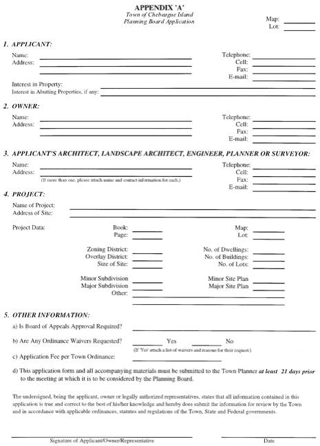
the required application form is included as Appendix A of this Ordinance. The Subdivision Review Fee Schedule is
established by order of the Board
of Selectmen. Outside consulting
fees shall be charged in accordance with Section 608 of the Zoning Ordinance. Appendices C and D
list the submission requirements for minor and major subdivision plans
respectively. Overall Subdivision
Review sheets for minor and major subdivision plans are included in Appendix E
and Appendix F respectively. An
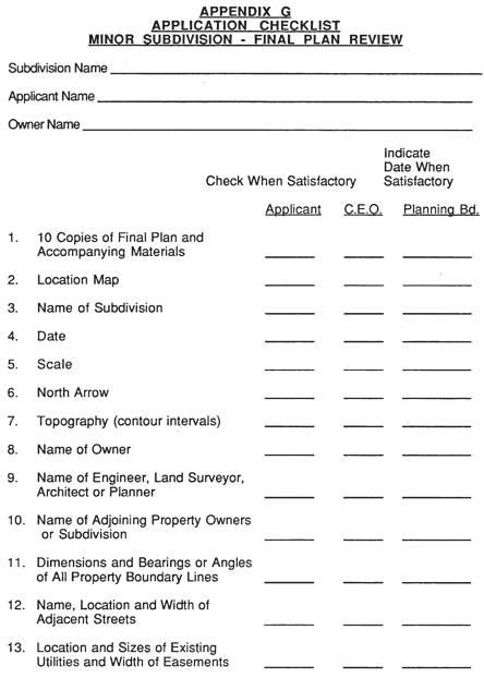
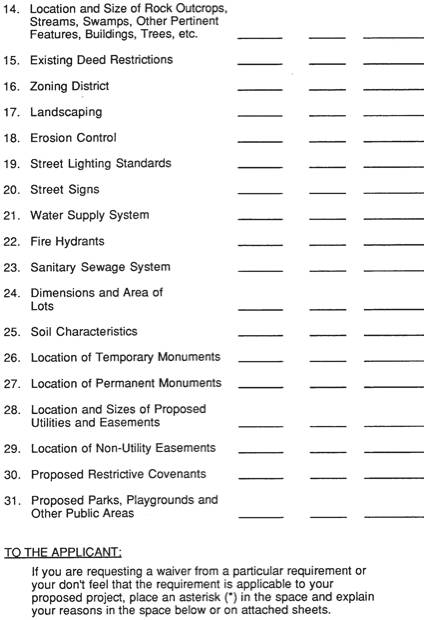
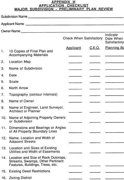
application checklist for minor subdivision plans is included in Appendix G. Appendix H contains an application
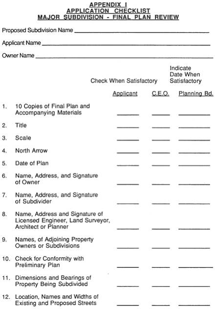
checklist for preliminary major subdivisions, and Appendix I contains an
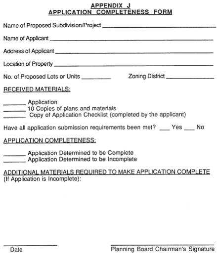
application checklist for final major subdivisions. Appendix J contains an Application Completeness form and
Appendix K contains a Notice of Decision form. In all instances throughout the subdivision review process,
the burden of proof shall be upon the person or persons proposing the
subdivision.
4.2 PRE-APPLICATION
CONFERENCE PROCESS
A subdivider may meet with the Planning Board
prior to formal submission of a plan to discuss his proposal. A sketch plan of the proposed
subdivision and other relevant materials may be presented by the
subdivider. The Planning Board may
ask questions of the subdivider and make general comments about the proposal.
4.3 REVIEW AND
APPROVAL OF PLAN FOR MINOR SUBDIVISION
A. General
The Planning Board may, where it deems it
necessary for the protection of public health, safety and welfare, require that
a Minor Subdivision comply with any or all of the requirements specified for
Major Subdivisions.
B. Procedures
1. An
application for final plan approval, a completed application checklist and ()
eleven (11) copies of the Final Plan and accompanying materials shall be
submitted to the Town Administrator at least twenty-one (21) days prior to the
meeting at which it is to be considered, and shall be accompanied by the fee,
which is established by order of the Board of Selectmen. If the application is
found to be deficient any additional information must be submitted no later
fourteen (14) days prior to the meeting at which it is to be considered.
2. The
Town Administrator shall then determine whether the application is complete or
incomplete and shall notify the applicant of the determination in writing
within 30 days of the date that the receipt is issued. If determined to be incomplete, the
Town Administrator shall list the
materials that must be submitted in order to make the application
complete. When the application is determined
to be complete, the Town
Administrator shall notify the applicant. Any application not determined to be complete within 180
days of the issued receipt date shall become null and void.
3. The
Planning Board shall, within 45 days from the date that the application is
determined to be complete, or within such other time that may be mutually
agreed to by both the Planning Board and the applicant, approve, approve with
conditions, or disapprove the Final Plan.
The Planning Board shall specify in writing its decision and findings of
fact regarding the decision. A
separate copy of the written decision and findings of fact shall be maintained
apart from the Planning Board minutes and stored in the Town Administrator’s files.
4. The
Planning Board, at its discretion, may hold a public hearing regarding any
proposed minor subdivision within 30 days of the determination of application
completeness.
C. Submission
Requirements
Minor Subdivision plan submissions shall conform
to the standards and requirements contained in Appendix C of this Ordinance.
D. Final
Plan Approval & Filing
1. Upon
completion of the requirements above and approval of the Final Plan, the Final
Plan shall be signed by a majority of the voting members of the Planning Board
and shall be filed by the applicant with the Cumberland County Registry of
Deeds.
2. Approval
of any subdivision plan not filed for recording within 90 days after Final Plan
approval shall become null and void.
A note referencing this time provision shall be placed upon the Final
Plan. The developer shall provide
the Town Administrator with the plan book number and page number, upon
recording of the subdivision plan.
4.4 REVIEW AND APPROVAL OF PLAN FOR
MAJOR SUBDIVISION
A. Sketch
Plan
1. The
purpose of the sketch plan approval is for the applicant to submit concept
plans for the following types of
subdivisions -- clusteredor traditional, and to receive the Board's decision as
to which type of development is most appropriate for the site, based upon a
consideration of all of the factors set forth in subsection 4. An application
for sketch plan review and eleven (11) copies of each sketch plan and
accompanying materials shall be submitted to the Town Planner at least
twenty-one (21) days prior to the meeting at which it is to be considered. If the application is found to be
deficient any additional information must be submitted no later fourteen (14)
days prior to the meeting at which it is to be considered.
2. The
applicant shall present the sketch plans and make a verbal presentation
regarding the site and the proposed development. The Board may ask questions and make suggestions to be
incorporated by the developer into the application.
3. The
sketch plan shall show, in simple form, the proposed layout of streets, lots,
building envelopes, and proposed open spaces. The plan shall include a delineation of topography,
wetlands, steep slopes, water bodies, adequate septic system locations, if
applicable, and other known natural features.
4. The
Board shall determine which type of subdivision best suits the property in
relation to the natural features of the land, adjacent properties and
neighborhoods, and the characteristics of open space to be maintained, if
applicable.
5. The
applicant shall be given a decision at the meeting what type of development is
most appropriate, or be told what additional information is necessary for the
Board to make a decision. The
Board shall specify in writing its decision within 10 days of the meeting.
6. The
type of subdivision development approved at the sketch plan meeting shall not
be changed unless the Board finds that unforeseen circumstances require the
decision to be altered.
7. The
acceptance of a sketch plan shall not be considered the initiation of the
review process for the purposes of bringing the plan under the protection of
1 M.R.S. § 302.
8. Following
the sketch plan meeting the Board shall establish a file for the proposed
subdivision. All correspondence
and submissions shall be maintained in the file.
B.
Preliminary Plan Procedures
1.
An application for
preliminary plan approval, a completed application checklist and eleven (11) copies of the Preliminary
Plan and accompanying materials shall be submitted to the Town Administrator at
least twenty-one (21) days prior to the meeting at which it is to be
considered, and shall be accompanied by the fee as established by order of the
Board of Selectmen. If the
application is found to be deficient, all additional information must be
submitted no later than fourteen (14) days prior to the meeting at which it is
to be considered.
2. The
Town Administrator shall
determine whether the application is complete or incomplete and shall notify
the applicant of the determination
in writing within 30 days of the date that the receipt is issued. If determined to be incomplete, the
Town Administrator shall list the
materials that must be submitted in order to make the application
complete. Any application not
determined to be complete within 180 days of the issued receipt date shall
become null and void.
3. A
public hearing shall be scheduled within 30 days after the date date that
the application is determined to
be complete, with written notice posted at the Town Office, given to property
owners within 500 feet of the proposed subdivision; and written notice to the
general public in a newspaper of general circulation in the Town. The Planning Board may, at its
discretion, hold any additional public hearings as it deems appropriate. Failure of any property owner or any
member of the public to receive a notice of the public hearing shall not
necessitate another public hearing and shall not invalidate the action of the
Planning Board.
4. The
Planning Board shall, within 30 days after the date of the last public hearing,
approve, approve with conditions, or disapprove the Preliminary Plan. The Planning Board shall specify in
writing its findings of fact and the Board's decision. A separate copy of the written decision
and findings of fact shall be maintained apart from the Planning Board minutes
and stored in the Town Planner’s files.
The Planning Board, at its discretion, may require annotations to be placed directly on
the Preliminary Plan.
5. Preliminary
Plan approval shall not constitute approval of the Final Plan, but rather shall
be deemed an expression of approval of the design submitted on the Preliminary
Plan as a guide to preparation of the Final Plan.
C.
Preliminary Plan Submission
Preliminary Plan submissions shall conform to the
standards and requirements contained in Appendix D of this Ordinance.
D.
Final Plan Procedures
1. An
application for Final Plan approval and a completed application checklist shall
be submitted to the Town
Administrator within 180 days after Preliminary Plan approval and at
least twenty-one (21) days prior to the meeting at which it is to be
considered, along with
eleven (11) copies of the Final Plan and accompanying materials. If the
application is found to be deficient all additional information must be
submitted no later fourteen (14) days prior to the meeting at which it is to be
considered. The 180 day time limit
may be extended by the Planning Board, at its discretion, if the subdivider
makes a written request for such an extension to the Planning Board prior to
the expiration of said 180 day time limit.
2. Prior
to submission of the Final Plan application, the subdivider shall have
fulfilled the following requirements:
(a) Written
approval shall be secured by the Maine Department of Environmental Protection,
if the proposed subdivision is subject to review by said Department;
(b) The
proposed water supply system shall be approved in writing by the Maine
Department of Human Services if a central water supply system is proposed;
(c) A
solid waste disposal plan shall be prepared, if deemed necessary by the
Planning Board during the Preliminary Plan review process.
(d) The proposed surface drainage plan or stormwater management plan and
the proposed soil erosion and sediment control plan shall be endorsed in
writing by the Cumberland County Soil and Water Conservation District. The soils report shall also be reviewed
in writing by the Cumberland County Soil and Water Conservation District.
3. The
Town Administrator shall then determine whether the application is complete or
incomplete and shall notify the applicant of the determination decision in writing
within 30 days of the date that the receipt is issued. If determined to be incomplete, the
Town Administrator shall list the
materials that must be submitted in order to make the application
complete.
4. A
public hearing may be scheduled by the Planning Board within 30 days after the
date of the Final Plan is determined to be complete, with adequate notice given
to the general public.
5. Prior
to the final plan approval, the Planning Board may grant approval to permit the
Plan to be divided into two or more sections and may impose such conditions
upon the phases as it deems necessary to insure the orderly development of the
subdivision. Each phase shall be
reviewed by the Planning Board, both as a potentially independent subdivision
and as a section of the total subdivision. Each phase shall constitute at least 25% of the total number
of lots contained in the approved final plan.
6. Prior
to Final Plan approval, the Planning Board shall set the terms and conditions
for a performance bond issued by a licensed bonding company or an irrevocable
letter of credit to secure completion of all required public improvements, or
restoration of the site as the Town deems appropriate, to be submitted by the
subdivider and approved by the Planning Board. All irrevocable letters of credit shall contain a provision
requiring the issuer to notify the Town
Administrator in writing of the scheduled expiration date within three
(3) months of such expiration date.
The terms and conditions shall include a maximum 2 year time limit and
an inflation clause. In the event
that a Final Plan is to be divided into two or more phases, the Planning Board
may require that the amount of the performance bond issued by a licensed bonding
company or the irrevocable letter of credit be commensurate with the level of
improvement to be undertaken in the section or sections to be filed with the
Registry of Deeds and may defer the remaining required amount(s) until the
remaining sections of the proposed subdivision are ready for filing with the
Registry of Deeds. The terms and
conditions of the performance guarantee for each phase shall include a maximum
two year time limit and an inflation clause.
7. The
Planning Board shall, within 60 days after the date that the Final Plan is determined
to be complete, or within such other time limit that may be mutually agreed to
by both the Planning Board and the applicant, approve, approve with conditions
or disapprove the Final Plan. The
Planning Board shall specify in writing its findings of fact and the Board's
decision. A separate copy of the
written decision and findings of fact shall be maintained apart from the
Planning Board minutes and stored in the Town Planner’s files. The Planning Board at its discretion
may require annotations to be placed directly on the Final Plan.
8. This
60 day time limit may be extended once by 30 days, by the Planning Board, if
the Board determines that additional information needs to be secured by the
subdivider or the Planning Board.
D. Final
Plan Submission
Final Plan submissions shall conform to the
standards and requirements contained in Appendix D of this Ordinance.
E. Final
Plan Approval and Filing
1. Upon
completion of the requirements above and approval of the Final Plan, the Final
Plan shall be signed by a majority of the voting members of the Planning Board
and shall be filed by the applicant with the Town Administrator.
2. The
performance bond or irrevocable letter of credit, with the terms and conditions
previously set by the Planning Board, shall be filed with the Town Administrator before the Final Plan is
released for recording by the developer at his expense with the Cumberland
County Registry of Deeds.
3. Approval
of any subdivision plan not filed for recording within 90 days after Final Plan
approval shall become null and void.
A note referencing this time provision shall be placed upon the Final
Plan. The developer shall provide
the Town Administrator with the plan book number and page number, upon
recording of the subdivision plan.
4.5 PLAN REVISIONS
AFTER APPROVAL
A. No
changes, erasures, modifications, or revisions shall be made in any Final Plan
after approval has been given by the Planning Board and endorsed in writing on
the Final Plan, unless said plan is first resubmitted and the Planning Board
approves any modifications. Any
application for subdivision approval that constitutes a revision or amendment
to a subdivision plan which has been previously approved shall indicate that
fact on the application and shall identify the original subdivision plan being
revised or amended. Approved
changes shall be endorsed on the revised Final Plan by the Planning Board, and
the Plan as modified should be recorded in the Cumberland County Registry of
Deeds within sixty (60) days after such approval. The developer shall provide the Town Administratorwith the plan book number
and page number, upon recording of the revised subdivision plan.
4.6 PUBLIC ACCEPTANCE
OF STREETS, RECREATION AREAS
A. When
a street, easement, open space area, park, playground, or other recreation area
is shown on the Final Plan, approval of the Plan shall not constitute an
acceptance by the Town of such areas.
All Plans shall be endorsed with the following note: "The approval of this Plan by the
Planning Board does not constitute acceptance by the Town of any street,
easement, open space area, park, playground, or other recreation area
thereon." The Planning Board
may also require the filing of a written agreement between the applicant and
the Board of Selectmen covering future deed and title requirement, dedication,
and provision for the cost of grading, development, equipment, and maintenance
of any such areas.
4.7 TIMES FOR
COMMENCEMENT AND COMPLETION OF CONSTRUCTION; PRE-CONSTRUCTION CONFERENCE
All improvements required by Section 6.1 and all
quasi-public improvements required by the Planning Board for approval of the
plan shall be completed no later than two (2) years after approval of the final
plan (for phased plans, these time periods shall apply separately for each
phase approved by the Planning Board); provided, however, the Planning Board
may grant an extension for a period not to exceed six (6) months for good cause
shown if such application is made prior to the two-year expiration date. Only one such extension may be granted.
Once commenced, all such improvements shall be
prosecuted diligently to completion.
Construction time shall not exceed six (6) months unless the Planning
Board, upon written application and for good cause shown, shall extend the
construction period. Prior to
commencement of construction there shall be a mandatory pre-construction
conference with the developer, his general contractor, the Code Enforcement
Officer, the Town Administrator and such other Town officials as deemed
appropriate by the Town Administrator to review the proposed construction
activities to assure compliance with the requirements of the Ordinance and any
special terms of the project's approval.
Also, notwithstanding the provisions of Section 4.4 (D) (7) and (E) (2)
to the contrary, the Planning Board at time of final approval may authorize a
delay in the filing of an effective performance guarantee until the
pre-construction conference provided satisfactory evidence of the developer's
ability to obtain the same is submitted at time of final plan approval.
SECTION
5 ENFORCEMENT
5.1 No plan of a
subdivision of land within the municipal boundaries which would constitute a
subdivision as defined herein shall hereafter be filed or recorded in the Registry
of Deeds until a Final Plan thereof shall have been approved by the Planning
Board in accordance with all of the requirements, design standards, and
construction specifications set forth elsewhere in these standards nor until
such approval shall have been entered on such Final Plan by the Planning Board.
5.2 No person, firm,
corporation or other legal entity may convey, offer or agree to convey any land
in a subdivision which has not been approved by the Planning Board and recorded
in the Registry of Deeds.
5.3 Any person, firm, corporation or other legal
entity who conveys, offers or agrees to convey any land in a subdivision which
has not been approved as required by this section or who builds or develops a
subdivision other than in strict conformance with the requirements of this
Ordinance and his approval, including any conditions attached thereto, shall be
subject to a civil action seeking injunctive relief to prevent any such
violation, restore or repair the land if appropriate, and be further subject to
a civil fine, attorney's fees and costs of court as provided under 30-A
M.R.S.A. §4452. The municipality
or the Code Enforcement Officer may institute such proceedings.
5.4 No public
utility, water district, sanitary district or any utility company of any kind
shall serve any lot in a subdivision for which a Final Plan has not been
approved by the Planning Board.
5.5 Not only is
making a subdivision without Planning Board approval a violation of law, but so
also within such a subdivision is grading or construction of roads, grading of
land or lots, or construction of buildings until such time as a Final Plan of
such subdivision shall have been duly prepared, submitted, reviewed, approved,
and endorsed as provided in these standards, and until the original copy of the
Final Plan so approved and endorsed has been duly recorded in the Cumberland
County Registry of Deeds.
SECTION
6 REQUIRED IMPROVEMENTS
6.1
The following
are required improvements: monuments, street signs, streets, byways, water
supply, sewage disposal, storm drainage, lighting and signing and pavement
markings for traffic control, walking and biking trails, erosion control, or
other improvements required by the Board, except where the Board may waive or
modify such improvements in accordance with the provisions of these
standards.
6.2
INSPECTION OF REQUIRED
IMPROVEMENTS
A. At
least five (5) days prior to commencing construction of required improvements
the subdivider shall:
1. Pay
an inspection fee equal to two (2) percent of the cost of the required
improvement, or
2. Pay
an inspection fee equal to the estimated cost of inspection by the Town
Engineer and/or Public Works Director if any, or
3. Pay
an inspection fee equal to the estimated cost of inspection by an engineer
appointed by the Planning Board payable by check to the Town of Chebeague Island, Maine stating the
purpose of the fee. The subdivider
shall notify the Municipal Officers in writing of the time when he/she proposes
to commence construction of such improvements so that the Municipal Officers
can cause inspection to be made to assure that all municipal specifications and
requirements shall be met during the construction of required improvements and
utilities required by the Planning Board.
Any amount in excess of actual cost shall be returned to the developer.
B. If
the Town Engineer, appointed engineer, or Director of Public Works shall find,
upon inspection of the improvements performed before expiration date of the
performance bond, that any of the required improvements have not been
constructed in accordance with plans and specifications filed by subdivider, he
shall so report to the Municipal Officers, Code Enforcement Officer, and
Planning Board. The Municipal Officers
shall then notify the subdivider and, if necessary, the bonding company, and
take all necessary steps to preserve the municipality's right under the
bond. No plan shall be approved by
the Planning Board as long as the subdivider is in default on a previously
approved plan.
C. If
at any time before or during the construction of the required improvements it
is demonstrated to the satisfaction of the Town Engineer or Town appointed
engineer that unforeseen conditions make it necessary or preferable to modify
the location or design of such required improvements, the Town Engineer or Town
appointed engineer may authorize modifications provided these modifications are
within the spirit and intent of the Planning Board's approval and do not extend
to the waiver or substantial alteration of the function of any improvements
required by the Board. The Town
Engineer or Town appointed engineer shall issue any authorization under this
section in writing and shall transmit a copy of such authorization to the Planning
Board at its next regular meeting.
D. The
applicant shall be required to maintain all improvements and provide for snow
removal on streets and sidewalks until acceptance of said improvements by the
legislative body.
E. Upon
completion of the subdivision, the subdivider shall notify the municipal
officers in writing stating that all improvements have been completed. Along with this statement shall be
submitted "as-built" record construction drawings on mylar which were
previously approved by the Planning Board.
SECTION
7 GENERAL REQUIREMENTS
7.1 In reviewing
applications for the subdivision of land, the Board shall consider the
following general requirements. In
all instances the burden of proof shall be upon the person proposing the
subdivision.
7.2 REVIEW AND
APPROVAL BY OTHER AGENCIES
A. Where
review and approval of any subdivisions or site plan by any other governmental
agency is required, such approval shall be submitted to the Planning Board in
writing prior to the submission of the Final Plan.
7.3 SUBDIVISION PLAN
SHALL CONFORM TO COMPREHENSIVE PLAN
A. Any
proposed subdivision shall be in conformity with a Comprehensive Plan or policy
statement of the municipality and with the provision of all pertinent state and
local codes and ordinances.
7.4 RELATIONSHIP OF
SUBDIVISION TO COMMUNITY SERVICES
A. Any
proposed subdivision shall be reviewed by the Board with respect to its effect
upon existing services and facilities.
The Final Preliminary Plan shall include a list of the construction
items that will be completed by the developer prior to the sale of lots; and
the list of construction and maintenance items that must be borne by the
municipality, which shall include, but not be limited to: Schools, including busing; Road
maintenance and snow removal; Police and fire protection; Solid Waste disposal;
Recreation Facilities; Runoff water disposal drainage ways and/or storm sewer
enlargement with sediment traps.
B. The
Board may require the developer to provide a Community Impact Statement to the
Town for the above services.
7.5 RETENTION OF
PROPOSED PUBLIC SITES AND OPEN SPACES
A. Depending
on the size and location of the subdivision, the Board may require the
developer to provide up to 10% of his total area for recreation. It is desirable that areas reserved for
recreation be at least 5 acres in size and easily accessible from all lots
within the subdivision.
B. Land
reserved for park and/or recreational purposes shall be of a character,
configuration and location suitable for the particular use intended. A site to be used for active
recreational purposes, such as a playground or a playfield, should be
relatively level and dry, have a total frontage on one or more streets of at
least 200 feet, and have no major dimensions of less than 200 feet. Sites selected primarily for scenic or
passive recreation purposes shall have such access as the Board may deem
suitable and shall have no less than 25 feet of road frontage. The configuration of such sites shall
be deemed adequate by the Board with regard to scenic attributes to be preserved,
together with sufficient areas for trails, lookouts, etc., where necessary and
appropriate.
C. Where
the proposed subdivision is located on a lake, pond, river, or stream, a
portion of the waterfront area, when feasible, shall be included in the reserved
land. The land so reserved shall
be at least 200 feet wide measured perpendicularly from the normal high water
mark.
D. The
Board may further require that the developer provide space for future municipal
uses, in accordance with a Comprehensive Plan or policy statement, giving the
Town first option on the property.
E.
The Planning Board
may require the developer to dedicate easements not less than ten (10) feet
wide to the Town over those areas of the subdivision that are shown on the
Town's Greenbelt Map enacted as part of the Town's ordinances. Such easements shall be for the benefit
of the public and the Town shall have the right, but not the obligation to
maintain such easements. Any such
dedication must be made through appropriate legal instruments approved by the
Town attorney.
F. The
Planning Board may require the developer of a mobile home park to provide
public open space for passive recreation, in an area and location to be
determined by the Board, for the purpose of providing recreational
opportunities for residents of the mobile home park.
7.6 PRESERVATION OF
NATURAL AND HISTORIC FEATURES
A. The
Board may require that a proposed subdivision design include a landscape plan
that will show the preservation of existing trees (10" diameter or more),
the replacement of trees and vegetation, graded contours, streams and the
preservation of scenic, historic, or environmentally desirable areas. The street and lot layout shall be
adapted to the topography and extensive grading and filling shall be avoided.
The
board shall require the developer to identify any historic buildings or sites
and/or historic or pre-historic archaeological sites.
7.7 LAND NOT SUITABLE
FOR DEVELOPMENT
A. The Board shall not approve any plan for
development that would alter the natural state of any of the following types of
land:
1. Are
located within the 100 year frequency flood plain as identified by an
authorized Federal or State agency, or when such identification is not
available, are located on flood plain soils identified and described in the
National Cooperative Standard Soil Survey.
2. Are
located on land which must be filled or drained or on land created by diverting
a watercourse; except the Board may grant approval if a central sewage
collection and treatment system is provided. In no instance shall the Board approve any part of a
subdivision located on filled tidal wetlands.
3. Contain
soils unsuitable for construction and development of structures due to their
very severe limitations of drainage, flooding, organic nature of settlement
properties, including Chocorua, Whately, Sebago, Saco, Saco-Limerick,
Borohemists, Borosaprists, and Sulfihemists.
7.8 BLOCKS
A. The
length, width and shape of blocks shall be determined with due regard to:
1. Provision
of adequate building sites suitable to the special needs of the type of use
contemplated;
2. Zoning
requirements as to lot sizes and dimensions;
3. Needs
for convenient access, circulation, control and safety of street traffic;
4. Limitations
and opportunities of topography.
B. In
blocks exceeding 800 feet in length, the Planning Board may require the
reservation of a 30-feet wide easement through the block to provide for the
crossing of underground utilities and pedestrian traffic where needed or
desirable and may further specify, at its discretion, that a five (5) foot wide
paved foot path be included.
7.9
LOTS
A. The
lot size, depth, width, shape and orientation and the minimum building setback
lines shall be appropriate for the location of the subdivision and for the type
of development and use contemplated.
B. Depth
and width of properties reserved or laid out for all purposes shall be adequate
to provide for off-street parking and service facilities for vehicles required
by the type of use and development contemplated.
C.
The subdividing of
the land shall be such as to provide that all lots shall have a minimum lot
frontage on a street which conforms to the requirements set by the Town of Chebeague Island Zoning Ordinance.
D. Double
frontage lots (lots with frontage on two streets that are opposite each other)
shall be avoided except where essential to provide separation of residential
development from traffic arteries or to overcome specific disadvantages of
topography and orientation.
E. A
subdivision in which the land cover type at the time of application is forested
shall maintain a wooded buffer strip no less than fifty (50) feet in width
along all existing public streets.
Buildings shall be restricted from open
fields, and shall be located within forested portions of the subdivisions. When the subdivision contains no forest
or insufficient forested portions to include the buildings, the subdivision
shall be designed to minimize the appearance of buildings when viewed from
existing public streets.
F. Side-lot
lines shall be substantially at right angles or radial to street lines.
G. Where
a tract is subdivided into lots substantially larger than the minimum size
required in the Zoning District in which a subdivision is located, the Board
may require that street and lots be laid out so as to permit future
resubdivision in accordance with the requirements contained in these standards.
H. Subdivision
lots with frontage on both the collector street and the subdivision road shall
be on a lot of at least 4 acres.
The existing land cover on these lots shall be preserved for a depth of
at least 75' along the collector street.
Buildings on these lots shall be sited in a manner which minimizes
impacts on areas such as farmlands, wildlife habitats, scenic areas and other
significant natural resources.
7.11 UTILITIES
A. The
size, type and location of public utilities, such as street lights,
electricity, telephones, gas lines, fire hydrants, etc., shall be approved by
the Board and installed in accordance with local practice.
B. Utilities
shall be installed underground except as otherwise approved by the Board.
7.14 WATER
SUPPLY
A.
Individual
wells shall be sited and constructed to prevent infiltration of surface water,
and contamination from subsurface waste water disposal systems and other
sources of potential contamination.
B.
Because they are
difficult to maintain in a sanitary condition, dug wells shall be permitted
only if it is not economically or technically feasible to develop other ground
water sources.
C.
Lot
design shall permit placement of wells, subsurface waste water disposal areas,
and reserve sites for subsurface waste water disposal areas in compliance with
the Maine Subsurface Wastewater Disposal Rules and the Well Drillers and Pump
Installers Rules.
D.
The subdivider
shall demonstrate by actual test that water meeting State of Maine Rules of the
Department of Health and Human Services Relating to Drinking water can be
supplied to the subdivision at the rate of at least 350 gallons per day per
dwelling unit..
E.
The subdivider
shall demonstrate by engineering reports prepared by a civil engineer
registered in the State of Maine, that the proposed subdivision will not result
in an undue burden on the sole source aquifer of the island.
F.
The Planning Board
may require the developer at his cost to evaluate the effect of withdrawal of
groundwater if on-site groundwater supply wells are proposed. An analysis of lowering of the water
table during pumping, ground subsidence, reduction in groundwater recharge,
saltwater intrusion and/or modification of groundwater flow patterns may be
required. The analysis may require
pump testing of on-site wells or measurements of soil and/or rock permeability,
measurement of existing groundwater levels, soil borings, and/or installation
of groundwater observation wells.
G. No development or use of land shall lower the
groundwater table more than 10 feet, reduce on-site groundwater recharge by
more than 20 percent, cause saltwater intrusion, undesirable change in
groundwater flow patterns, or cause ground subsidence of more than 1 inch on
abutting property. If the analysis
of groundwater withdrawal (Section 7.14 F above)
shows that one or more of these effects will occur, that will be the basis for
denial of the application.
.
H.
If a central water
supply system is provided by the subdivider, location and protection of the
source, and design, construction and operation of the distribution system and
appurtenances and treatment facilities shall conform to the recommendations
included in the State of Maine Rules of the Department of Human Services
Relating to Drinking Water
7.15 SEWAGE
DISPOSAL
A. Sewage disposal shall be by private
subsurface waste water disposal systems or by a private treatment facility with
surface discharge, licensed by the Department of Enfironmental Protection.
B. A
developer shall submit plans for sewage disposal designed by a professional
engineer and/or licensed site evaluator, as appropriate, in full compliance with
the requirements of the State of Maine Plumbing Code, except as noted herein or
in the Zoning Ordinance.
C. The
Board may require a hydrogeologic evaluation where it is concerned about
possible groundwater or surface water contamination. Any cluster system shall require a hydrogeologic
investigation. The investigation
could involve soil borings and installing groundwater observation wells,
measurement of groundwater elevation at wells, estimation of the direction and
rate of ground water flow, hydraulic mounding estimate beneath any leachfield,
measurement of existing groundwater and/or surface water quality,
identification of existing water supply wells or springs on abutting
properties, and a projection by analytical methods of groundwater and/or surface
water quality within and at the property boundaries as a result of
development.
D. The
Developer shall specify the location, both horizontally and vertically, of
on-site well and septic systems to avoid contamination of proposed or existing
water supplies by septic system effluent.
Any septic system
must be placed at least 100 feet from any existing well, whether the well is on
the property or on contiguous property. No development or use of land shall
result in existing groundwater quality exceeding 50 percent of the physical,
biological, chemical and radiological levels for raw and untreated drinking
water supply sources specified in the Maine State Drinking Water Regulations,
pursuant to 22 M.R.S. § 601.
If existing groundwater quality is inferior to the State Drinking Water
Regulations, the developer or land owner will not degrade the water quality any
further. This criterion shall
apply to the property boundaries existing and proposed water supply wells and
springs. If the hydrogeologic evaluation
and projection of groundwater and/or surface water quality (Section 7.15C above) show that the effect of the development or use
of land will be to exceed whichever of these groundwater quality standards
applies, that will be the basis for denial of the application.
7.16 ADDITIONAL
REQUIREMENTS
A. Street
trees, esplanades, and open green spaces may be required at the discretion of
the Planning Board. Where such
improvements are required, they shall be incorporated in the Final Plan and
executed by the subdivider as construction of the subdivision progresses.
B. The
subdivision design shall minimize the possibility of noise pollution either
from within or without the development (from highway or industrial sources) by
providing and maintaining a planting screen easement at least 20 feet wide,
except as may otherwise be required by the Zoning Ordinance, between abutting
properties that are so endangered.
SECTION
8 STREET DESIGN AND
CONSTRUCTION STANDARDS
8.1 STREETS
(GENERAL)
A. Classification
In accordance with the Comprehensive Plan of the
Town of Chebeague Island and for
the purposes of these standards, streets are classified according to the
average daily traffic (ADT) they are intended to serve, as calculated by the
number of Average Daily Trips; as
follows:
1[MSOffice3] . Average Daily Trip - Average daily trip
shall be defined as the anticipated number of daily vehicle trips generated by
a use as established by the Trip Generation Manual, published by the Institute of Transportation
Engineers, 1991. If the developer
disagrees with the estimated number of trips per day generated by a particular
use, as listed by the Trip Generation Manual, published by the Institute of Transportation
Engineers, the developer may request a waiver of these standards if information
is submitted demonstrating that the Trip Generation Manual estimate is inaccurate. Table 8-1 lists estimated number of average weekday trips for residential uses.
Table
8-1
Housing Type Average
Weekday Trip
Generation Rates
Single-family detached 10
trips/dwelling unit
Duplex, multiplex, 8
trips/dwelling unit
Mobile Home 5.5
trips/dwelling unit
Retirement Home 3.5
trips/dwelling unit
1. Arterial
Streets: Arterial streets and
highways serve primarily as major traffic ways for travel between and through
towns.
2. Residential
Private Streets: Private
streets serve as feeders to access, sub-collectors, and collector residential
streets, and may be the principal entrance streets of a residential
development. Private streets are
permitted only when the average daily traffic is less than 50.
3. Residential
Access Streets: Access streets
serve primarily for access to abutting residential properties, and as feeders
to other residential streets of equal of greater capacity. Access streets are intended to serve
developments with average daily trips less than 200.
4. Residential
Sub-collector Streets:
Sub-collector streets serve as collectors from access or private streets
and as feeders to collector streets; they are intended to serve developments
with average daily trips of 200 - 500.
5. Residential
Collector Street - Collector streets serve as collectors from Sub-collector
streets and as feeders to arterial streets, they are intended to serve
developments with average daily trips greater than 500.
6. Commercial
Access Streets - Access streets shall be defined as streets servicing
commercial and industrial developments with average daily trips less than 2000.
7. Commercial
Collector Streets - Collector streets shall be defined as streets servicing
commercial and industrial developments with average daily trips greater than
2000.
8. Classification
of street types will be made by the Planning Board within the considerations
outlined above.
B. Layout
1. Proposed
streets shall conform, as far as practical, to such Comprehensive Plan or
policy statement as may have been adopted, in whole or in part, prior to the
submission of a Preliminary Plan.
2. All
streets in the subdivision shall be so designed that, in the opinion of the
Board, they will provide safe vehicular travel while discouraging movement of
through traffic over local streets.
3. The
arrangement, character, extent, width, grade and location of all streets shall
be considered in their relation to existing or planned streets, to
topographical conditions to public convenience and safety, and their
appropriate relation to the proposed use of the land to be served by such
streets. Grades of streets shall
conform as closely as possible to the original topography.
4. In
the case of dead-end streets, where needed or desirable, the Board may require
the reservation of a minimum thirty (30) foot wide utility easement and/or
minimum twenty (20) foot wide right-of-way for pedestrian and/or bicycle
traffic.
The
Board may require that additional right-of-way widths be provided if it
determines that future extension of the street may occur. Such additional widths shall be
consistent with the right-of-way width of the dead-end street.
5. In
front of areas zoned and designed for commercial use, or where a change of
zoning to a zone which permits commercial use is contemplated by the
municipality, the street right-of-way and/or pavement width shall be increased
by such amount on each side as may be deemed necessary by the Board to assure
the free flow of through traffic without interference by parked or parking
vehicles, and to provide adequate and safe parking space for such commercial or
business district. In no case shall
the street have a right-of-way width and pavement width less than that
specified in Table 8-3.
6. Where
a subdivision borders an existing narrow road (below standards set herein) or
when the Comprehensive Plan indicates plans for realignment or widening of a
road that would require use of some of the land in the subdivision, the
subdivider shall be required to show areas for widening or realigning such
roads on the Plan, marked "Reserved for Road Realignment (or Widening)
Purposes." It shall be
mandatory to indicate such reservation on the Plan when a proposed widening or
realignment is shown on the Official Map.
Land reserved for such purposes may not be counted in satisfying setback
or yard or area requirements of the Zoning Ordinance.
7. The
extension or continuation of an existing street, right-of-way less than that
specified herein, may be permitted with the approval of the Planning Board.
8. If
deemed necessary by the Planning Board, the subdivision may be required to
provide at least two street connections with existing public streets or streets
on an approved Subdivision Plan for which a bond has been filed.
9. Utility
plans must be approved by the responsible utilities. Copies of written approval shall be submitted to the Board
at the time of final review.
10. If
the Planning Board determines that future development will occur on land
adjacent to or near the proposed subdivision, whether it is owned by the
applicant or not, then the Board shall retain the right to require the
developer to meet the requirements for collector street design and construction
as specified herein at no cost to the Town.
C. Street
Signs, and Names
1. Streets
which join or are in alignment with streets of abutting or neighboring
properties shall bear the same name.
Names of new streets shall not duplicate, nor bear phonetic resemblance
to the names of existing streets within the municipality and shall be subject
to the approval of the Board.
2. Street
name signs shall be furnished and installed by the subdivider. The type, size and location shall be to
the approval of the Board.
D. Traffic
Control Devices
The Developer shall furnish and place all
appropriate signing and pavement markings required for the proper control of
pedestrian, bicycle and vehicular traffic within the subdivision. The types and locations of all such
devices shall be determined by the Planning Board, and Town Engineer and shall
be in conformance with the "Manual on Uniform Traffic Control
Devices" as currently revised.
E. Street
Lighting
The Developer shall coordinate with the appropriate
servicing utility and the Road Commissioner for furnishing, locating and
placing of any lighting. Light
poles and luminaries shall be a type approved by the Planning Board and said
utility.
F. Byways
shall be provided along all roads within a proposed development.
G.
Private Ways
A. Private
ways built to the "private residential "standards of this section shall
not be accepted as a public way; provided, however, that privately owned roads
in mobile home parks are exempt from the requirements set forth in Section 8
but shall be considered as "streets" for building purposes. If at a future date users of the road
upgrade the private way to the standards set forth in Section 8, the users may petition
the Board of Selectmen for the acceptance of the road as a public way at the
next Town Meeting. The plan shall
contain a note which shall read, "The Town of Chebeague Island shall not
be responsible for the maintenance, repair, plowing, or similar services for
the private way shown on this plan.”
8.2 DESIGN
AND CONSTRUCTION STANDARDS
A. All
streets in the subdivision shall be designed and constructed to meet the
following standards for streets according to their classification, including
whether Urban or Rural standards apply, as determined by the Planning Board:
1. Urban: Urban standards shall apply to all
roads that are constructed using subsurface drainage and curbing. Urban standards may be applied to
"Rural" roads at the Planning Board's discretion, if conditions so
warrant such as topography, soil conditions and aesthetics. Urban design standards shall be defined
as paved streets with such appurtenances as curbs, esplanades, byway, and an
enclosed storm drainage system with catch basins, manholes, and associated
piping.
The
Planning Board shall require the provision of a byway under the urban design
standards, which for purposes of this subparagraph A.1. shall include only a
sidewalk or freewalk; provided however, that under the waiver standard set
forth in Section 15 of this ordinance, a freewalk may be substituted for a
sidewalk if in the opinion of the Board such substitution will not
significantly lessen drainage efficiency, or the requirement of a byway may be
waived altogether.
2. Rural: Rural design standards as tabulated
herein shall be used for all street designs in the Town of Chebeague Island, except as specified
above. Rural design standards
shall be defined as paved streets with gravel shoulder, side ditches for the
transportation of storm water and a byway.
The
Planning Board shall require the provision of a byway under the rural design
standards, which for purposes of this subparagraph A.2. shall include only a
freewalk or paved shoulder; provided however, that under the waiver standard
set forth in Section 15 of this ordinance, a paved shoulder may be substituted
for a freewalk, or the requirement of a byway may be waived altogether.
B. Dimensions
of Street Construction
The
dimensions for street construction shall conform with Table 8-2
C. Minimum
sight distance for all streets and roadways, except local and private streets,
shall be calculated using the standard of 10 feet of sight distance per every 1
mile of posted speed limit. This
standard may be reasonably reduced by the Planning Board for local and private
streets, where appropriate. Sight
distance requirements at intersections shall follow the guidelines specified in
"A Policy on
Geometric
Design of Highways and Streets, 1984" as published by the American
Association of State Highway and Transportation Officials.
D. Dead
End Streets
1. Presentation
of special design, discussion and written permission by the Planning Board
shall be required for those conditions that may require dead end streets under
the category of Residential Sub-Collector, Residential Collector, Commercial
Access, or Commercial Collector.
2. The
terminus of any dead end street must have a cul-de-sac, with standards as
listed in Section 3 below. Other
types of turn around may be approved by the Planning Board after receiving a
recommendation by the Fire Chief and Public Works Director. Cul-de-sac island area shall be
restricted to grass or where the radius is large enough the Planning Board may
permit other cover types.
3. Standards
as listed under Section B shall be applicable for dead-end streets. In addition, the following requirements
shall be fulfilled:
a. Maximum
length of dead-end streets shall be limited to 2,000 feet measured from the
centerline of the feeder street to the center of the turnaround radius. However, the Planning Board may allow
longer lengths because of property configuration and/or topographical
constraints.
b. Radii
at Cul-de-sac with Center Island:
Property line: 70
feet
Outer edge of pavement: 60
feet
Inner edge of pavement: 30
feet
c. Radii
at Cul-de-sac without Center Island:
Property line: 60
feet
Over edge of pavement: 50
feet
4. At
the end of temporary dead-end streets, a temporary turnaround with an outside
roadway diameter of 90 feet or a backing space extending at least thirty (30)
feet from the edge of the street, and thirty (30) feet beyond the edge of the
backing space. Pavement widths for
backing spaces shall be identical to the type of street involved.
E. Driveways
1. Driveways
shall be designed and constructed in such a way so as to preclude the
possibility of damage to the underside of vehicles due to excessive changes in
grade. Dimensions and break-over
angles of vehicles, such as those published by the Automobile Manufacturing Association,
should be used as a guide in the design and construction of all driveways
within the subdivision.
2. Where
streets are built to urban standards, driveways shall enter a street at the
level of the edge of the traveled way.
They shall, in no way, impede the flow of storm water along the gutter
line. Where a driveway crosses a
sidewalk or a reservation for same, it shall do so with little or no change in
the longitudinal grade at the back edge of the sidewalk. All driveways shall be paved to a point
at least four feet beyond the right-of-way in order to prevent damage to
sidewalk areas.
3. Where
streets are built to rural standards, driveways shall enter a street at the
level of the outer edge of the gravel shoulder. They shall be graded in such a manner so as to direct as
much storm water as practical into roadside ditches. All driveways shall be paved to the street
right-of-way. Such paving shall
include the gravel shoulder of the roadway; and when completed, it shall be at
the proposed grade of the gravel shoulder.
4. All
driveways shall be constructed with adequate drainage systems to prevent water
flow from entering garages or basements.
5. The
portion of any driveway within the right-of-way shall be constructed to the
same road construction materials standards as the adjoining road.
8.3 ROADWAY
CONSTRUCTION MATERIALS
A. General
1. Roadway
construction materials as specified herein shall conform to the current
specifications of the Maine Department of Transportation.
2. Standards
and dimensions tabulated herein shall be considered as minimum. The subdivider shall be required to
investigate and determine the types and classifications of the soils. Computations shall be made to determine
pavement design standards for construction, which shall be submitted to the
Town Engineer for review.
If
the existing native soil through the sub-base course area can be defined as
being equal in quality and thickness to the minimum requirements specified
herein, the Planning Board may waive a portion or all of the minimum
requirements for sub-base courses.
In any event, the ultimate density of any material left in place shall
conform to the minimum requirements for compaction specified in Section 9.4(B)
contained herein.
If,
during construction, subsurface soils vary from the original classification,
the pavement design shall be modified to reflect the new soil types. Revised pavement designs shall be
submitted to the Town Engineer for approval.
B. Materials
1. The
minimum thickness of the various materials courses shall be shown in Table 8-3.
2. Curbing
Materials
Curbing
materials shall be either granite stone curbing, Type 1; or Bituminous curbing,
Type 3. Type 1 vertical circular
curbing shall be used for radii at intersections.
3. Minimum
paving requirements on island street shall consist of a penetration treated
surface using asphalt. Bituminous
surface treatment shall consist of a prime coat using a low viscosity liquid
bituminous material to coat and bind mineral particles. A coat of cover material - sand - will
be required. After a minimum five
(5) day curing period or such other time as the Road Commissioner may require,
a seal coat consisting of bituminous material and a sand cover shall be
applied. Bituminous materials,
their application rates and the cover material to be used, shall be approved by
the Road Commissioner prior to paving.
8.4 CONSTRUCTION
STANDARDS
All streets within the subdivision shall be
constructed according to the specifications herein as overseen by the Road
Commissioner and/or Town Engineer.
A. Grading: All streets shall be graded to their
full width by the subdivider so that pavements and sidewalks can be constructed
on parallel profiles. Due to
special topographical conditions, deviation from the above will be allowed only
with special approval of the Planning Board.
1. Preparation: Before grading is started, the entire
right-of-way area shall be cleared of all stumps, roots, brush, and other
objectionable material and all trees not intended for preservation.
2. Cuts: Tree stumps, roots, and other organic
materials shall be removed to a depth of two (2) feet below the subgrade. Rock and boulders, when encountered,
shall be removed to subgrade.
3. Fill: All materials used in the construction
of embankments shall meet the standards for embankment construction, Section
203.09 through 203.16 of the Maine Department of Transportation Standard
Specifications. Excess material
including organic materials, etc., shall be removed from the street site. The fill shall be spread in layers not
to exceed twelve (12) inches loose and compacted. The filling of utility trenches and other such areas shall
be mechanically tamped.
4. All
underground utilities and their services shall be installed within the street
right-of-way prior to placement of the aggregate base course (crushed gravel).
5. Side
Slopes: All side slopes shall be a
maximum slope of three (3) horizontal to one (1) vertical. All slopes shall be graded, loamed
(four inches compacted), fertilized, limed and seeded as required.
B. Bases
and Pavement
The appropriate sections of the Bases and
Pavements Divisions of the Maine Department of Transportation Standard
Specifications currently in effect at the date of submission of the preliminary
plan shall be applicable.
Bases:
1. Aggregate
Sub-base Course - Gravel (Type D).
Aggregate sub-base shall not contain particles of
rock exceeding six (6) inches in any dimension.
Aggregate Base Course - Crushed (Type A).
Aggregate base shall not contain particles of
rock that will not pass the 2 inch square mesh sieve.
2. Where
pavement placed joins an existing pavement, the existing pavement shall be cut
along a smooth line and to a neat, even, vertical, joint. Broken or raveled edges will not be
permitted, nor deviation from grade.
Gradation
of aggregates for Plant Mix Hot Bituminous Pavements shall be as specified in
Division 700 of the Maine Department of Transportation Standard Specifications.
C. Curbing: Section 609 of the Maine Department of
Transportation Standard Specifications shall be applicable to this section,
except as follows:
1. Curbing
shall be limited to Type 1 and Type 3.
2. Vertical
or sloped curbing shall be used in accordance with the design standards set
forth herein for the particular type of street. All curbs shall have a typical reveal of six (6) inches.
3. Type
1 curbing shall be used for radii at all intersections.
D. Byways:
1. Sidewalk: Sidewalk construction shall comply with
Section 608 of the Maine Department of Transportation Standard
Specifications. Sidewalks shall
have typical cross slopes of 3/8"/foot.
2. Freewalk: A freewalk shall be 4 feet wide, shall
consist of 2-inch thick asphalt with an 8-inch gravel subsurface and shall be
separated from the paved portion of the road by a grassy esplanade with a
minimum width of 4 feet.
3. Paved
Shoulder: A paved shoulder shall
be constructed to the same road construction materials standards as the
adjoining road. The paved shoulder
shall be contiguous with the roadbed and shall be separated from the roadway by
a painted, solid white line.
8.6 MONUMENTS
A. Granite
or precast reinforced portland cement concrete monuments four (4) inches
square, four (4) feet long with a flat top shall be set at the following
locations:
1. All
street corners;
2. All
points where the street line intersects the exterior of the subdivision; and,
3. All
angle points or all points of horizontal curvature in each street.
The tops of monuments shall have an indented
cross or drill hole to properly identify the location and shall be set flush
with the finished grade.
B. All
other lot corners shall be marked with iron pipe not less than one (1) inch in
diameter and forty-eight (48) inches long and driven so as to be flushed with
the finished grade.
SECTION 9
STORM DRAINAGE DESIGN AND CONSTRUCTION STANDARDS
9.1 INTENT
An adequate stormwater control and conveyance
system shall be provided including appurtenances such as sediment and detention
basins as needed, and catch basins, manholes, and piped or professionally
designed ditch conveyance systems to assure that stormwater discharged from the
site are in compliance with the guidelines contained herein and all other
requirements of this Ordinance.
9.2 DEFINITIONS
A. Urban
Systems: Storm drainage facilities
located within areas defined by this ordinance as urban shall be an enclosed
underground system capable of effectively removing stormwater from the street
and adjacent areas. Discharge of
stormwater shall be into natural drainage courses.
Storm drainage systems conforming to the
standards specified herein may be constructed in rural areas at the option of
the developer or if required by the Planning Board.
If conditions warrant, the Planning Board may
allow a combination of rural and urban drainage standards or utilize rural
standards entirely.
B. Rural
Systems: Storm drainage facilities
located within areas defined by this ordinance as rural shall consist of a
system of culverts and open drainage channels capable of effectively carrying
stormwater into natural drainage courses.
9.3 STORM WATER
MANAGEMENT PLAN REQUIRED
All subdivision applications shall contain a
surface drainage plan with profiles and cross sections designed by a State of
Maine registered professional engineer.
This plan shall show ditches, culverts, easements and other proposed
improvements with the statement in writing attached to the drainage plan
indicating that the proposed subdivision will not create erosion, drainage or
runoff problems either in the subdivision or in adjacent properties; and, file
with the Planning Board properly executed easements as required by the Planning
Board. The plan shall also contain
a soil erosion and sediment control plan containing the endorsement of the
Cumberland County Soil and Water Conservation District.
Applications submitted pursuant to this Ordinance
for projects which will expose more than 60,000 square feet of soil at one time
or which will produce more than 10,000 square feet of additional impervious
surface must submit a stormwater management plan to the Planning Board for its
review and approval.
9.4 PERFORMANCE
STANDARDS
Stormwater Management Plans shall show means
whereby the peak discharge for the developed site shall not exceed the peak
discharge for the undeveloped site for the 2 and 25 year storms. Emergency overflow facilities shall be
provided for storms in excess of the 25 year storm. Sediments and other pollutants shall be limited through
appropriate management practices to prevent adverse downstream water quality
impacts. Regulations specifying
hydraulic calculation techniques and design standards for facilities to achieve
this performance standard shall be as approved by the Planning Board.
9.5 DESIGN STANDARDS
A. General
1. All
stormwater systems within the subdivision shall be designed to meet the
criteria of the performance standards for a twenty-five storm based on rainfall
data from the National Weather Service records in Portland. Flows shall be computed by appropriate
professional methods with design computations being submitted for review.
2. Upstream
drainage shall be accommodated by an adequately sized drainage system through
the proposed subdivision for existing and future potential development in the
upstream drainage area or areas tributary to the proposed subdivision as determined
by the Planning Board.
3. Existing
downstream drainage facilities shall be studied to determine the affect of the
proposed subdivision's drainage.
The developer shall demonstrate to the satisfaction of the Planning
Board that the storm drainage from the proposed subdivision will not, in any
way, overload or damage existing storm drainage systems downstream from the
proposed subdivision.
4. Where
open ditches (other than roadway ditches), channels, streams, or natural
drainage courses are used to collect, discharge, and/or transmit water through
the development, an adequately sized, perpetual drainage easement shall be
provided. Said easement shall be
centered as closely as possible to the middle of the watercourse and shall be
no less than thirty (30) feet in width.
5. Where
subsurface soils are poorly drained, an underdrain system may be required by
the Planning Board. Underdrains
shall be installed and discharged in a positive manner.
B. Urban
1. Design
standards for urban drainage systems shall be approved by the Planning Board.
2. Minimum
pipe size for any storm drainage pipe shall be twelve (12) inches.
3. Design
of storm drains shall be on a basis of flowing full at a minimum velocity of
2.5 feet per second.
4. Three
hundred (300) feet shall be considered as a maximum length for carrying storm
water in a street gutter prior to intake at a catch basin.
5. No
water shall be permitted to drain across a street or an intersection.
6. Manholes
shall be placed at all vertical or horizontal changes in the alignment of
pipe. However, in no case shall
manholes be spaced at intervals exceeding four hundred (400) feet, unless
otherwise approved by the Planning Board.
7. Drains
shall be designed such that a minimum of four (4) feet of cover over the pipe
is provided in paved areas and/or three (3) feet of cover is provided in
unpaved areas outside the street right-of-way.
8. The
Planning Board may require that house foundation drains be connected to the
storm drainage system. All
connections shall be made with wyes, tees, or saddles which are compatible with
the storm drain. All such work
shall be done under the supervision of the Plumbing Inspector.
C. Rural
1. Design
standards for rural drainage systems shall be approved by the Planning Board.
2. Roadside
ditches and outlet channels shall be of a configuration and size to carry the
contributory storm water and subsurface flows from the roadway structure and
roadside embankments. In all
instances the invert of the ditch shall be a minimum of six (6) inches below
the subgrade of the roadway extended to the shoulder except as modified below:
a. In
areas of well drained native soils; or
b. In
areas where subsurface soils are of a nature requiring an under drain system,
subgrades may be constructed to direct subsurface water to the underdrain
pipes.
3. Ditch
linings shall be provided to protect the side and slopes and bottom from
erosion and scour. Minimum channel
linings for corresponding longitudinal slopes shall conform to the following table:
0-3% - Loam
and seed
3-6% - Loam
and seed, protected by erosion control mesh
6-8% - Sod
placed over loam
Over 8% - Stone,
masonry, bituminous concrete or metal linings.
Ditches
adjacent to roadways shall be of a configuration that does not create a hazard
to vehicular traffic.
4. Culverts
a. Cross
Culverts: Culverts crossing under
roads or streets shall be sized to pass a twenty-five (25) year frequency storm
from the contributing drainage area without hydrostatic head. Design shall be based on accepted
hydrological methods and culvert capacity analysis. Minimum culvert diameter shall be fifteen (15) inches.
b. Driveway
Culverts: Culverts shall be
installed under any proposed or existing driveway that interrupts natural or
proposed longitudinal drainage along any street or road. Driveway culverts shall be of a size
capable of passing the amount of storm water equal to the next upstream culvert
within the same drainage course.
Driveway culverts shall have a minimum diameter of twelve (12) inches. Final determination of culvert size
shall be determined by the Road Commissioner.
c. Minimum
cover over culverts in roadway areas shall be twenty-four (24) inches. Minimum cover over driveway culverts
shall be twelve (12) inches.
9.6 MATERIALS
A. The
following material shall be utilized for storm drain construction:
1. Reinforced
Concrete Pipe (Urban and Rural):
Reinforced concrete pipe and fittings shall meet the requirement of ASTM
Designation C-76. The
classification of pipe shall be as required to meet soil and traffic loads with
a factor of safety of 1.0 on the .01 inch crack strength with a class B
bedding. Joints shall be of the
rubber gasket type meeting ASTM Designation C-443, or of an approved pre-formed
plastic jointing material such as "Ramnek".
2. Polyvinyl
Chloride (PVC) Pipe. PVC pipe and
fittings shall conform to the requirements of AASHTO M278. All pipe shall be supplied with gasket
type joints meeting the requirements of ASTM D3212. Pipe shall be designed to withstand soil and traffic loads
with a maximum deflection of 5% in diameter.
3. Corrugated
Metal Pipe (Rural): Corrugated
metal pipe and fittings shall be plain galvanized, aluminum or bituminous
coated conforming to the requirements of Section 707 - Metallic Pipe, of the
State of Maine Department of Transportation Standard Specifications. All pipe shall be of sufficient gauge
to withstand soil and traffic loads with a maximum deflection of 5%.
4. Underdrain
Pipe (Urban and Rural): Underdrain
pipe may be of polyvinyl chloride (PVC) perforated pipe meeting the
requirements of AASHTO M278 or perforated bituminous coated corrugated metal
pipe meeting the requirements of AASHTO M136 and shall be coated with
bituminous material to meet the requirements of AASHTO M190, Type A
coating. Coupling bands shall be
fully coated.
5. Manholes: Manholes shall be of precast concrete
sections construction or of precast concrete block construction. Precast units shall conform to the
requirements of ASTM Designation C-478.
Precast concrete manhole blocks shall be of load-bearing masonry units
meeting the requirements of ASTM Designation C-139, radial type. Manhole cones shall be truncated. Manhole bases may be cast-in place
concrete with a 28 day strength of 3000 psi, or may be of precast concrete.
Concrete
block manholes shall be treated with two coats of asphalt waterproofing
material conforming to ASTM Designation D-41 or a cement base coating suitable
for brush coat application.
Manhole
steps shall be dropfront type of cast aluminum conforming to Federal
Specification QQ-A-200/8 aluminum magnesium silicide type alloy. All steps shall be cast into the walls
of the manholes so as to form a continuous ladder with a distance of twelve
(12) inches between steps.
Manhole
frames and covers shall be either a "M24 x 8 manhole" or "E24 x
5 manhole" as manufactured by Etheridge Foundry of Portland, Maine, or an
approved equal. Covers shall be
solid diamond and marked "storm".
Manhole
inverts shall be constructed of brick and shall be shaped to the crown of the
pipe for sizes up to eighteen (18) inches and to the spring line for larger
pipes.
6. Catch
Basins: Catch basins shall be of
precast concrete construction or of precast concrete block construction
conforming to the appropriate ASTM Designations specified in subsection 5
(Manholes) above.
Castings
shall be twenty-four (24) inch square grating Type M as manufactured by
Etheridge Foundry, Portland, Maine, or an approved equal. All catch basins shall be provided with
a curb face inlet unless otherwise approved by the Road Commissioner.
Catch
basins shall have a minimum two (2) foot sump for retention of water borne
solids.
7. Catch
Basin Drain Pipe: Catch basin
drain pipe shall be of the same material as the main storm drain and shall meet
the design requirements as specified in "1" above for the material
being used. Catch basin leads
shall enter the drain at manholes or at tee or wye fittings. When entering at manholes, the invert
elevations of the lead and the main drain shall not be greater than twelve (12)
inches. Where the difference in
invert elevations differ by more than twelve (12) inches, drop connections will
be provided.
9.7 GENERAL
CONSTRUCTION REQUIREMENTS
A. All
trenching shall be accomplished in accordance with all appropriate state and
federal safety requirements.
B. Maximum
trench width at the pipe crown shall be the outside diameter of the pipe plus
two (2) feet.
C. Pipe
shall be bedded in crushed or screened stone with a minimum depth of six (6)
inches to provide a Class B bedding.
The stone will be deposited in the trench and brought to proper invert
grade. The maximum size of stone
aggregate will be three-fourths (3/4) inch. When the trench bottom has been excavated, it shall be
filled and thoroughly compacted to grade before the utility pipe is
placed. When the excavated trench
bottom is not sufficiently firm to properly support the utility pipe, the Town
Engineer may direct the subdivider to excavate below grade and bed the trench
bottom with a specified depth of select material. Unless otherwise shown on the final plan, the stone shall be
brought to the spring line of the pipe.
Bedding materials other than those stated above may be used but only by
a written statement from the Town Engineer. The statement will include a description of materials that
will be substituted.
D. Pipe
alignment shall be straight in both the horizontal and vertical unless specific
approval of a curvilinear drain is obtained in writing from the Planning Board.
E. Manholes
shall be provided at all changes in vertical or horizontal alignment, and at
all junctions. On straight runs,
manholes shall be placed at a maximum of four hundred (400) foot intervals.
F. Manholes
and catch basins shall be founded below the frost line on a minimum depth of
six (6) inches of crushed or screened gravel compacted to a uniform density.
G. All
drain outlets shall be terminated in a concrete end wall or shall be riprapped
to prevent erosion. Facilities for
energy dissipation shall be provided.
Culvert pipe inlets shall be constructed so as to prevent or decrease
damage to embankment and/or to improve efficiency of the culvert. Inlet control devices shall be as
approved by the Town Engineer.
H. Underdrains
shall be laid with perforations down on a minimum six (6) inch bed of granular
material used for the bed.
Granular material for bedding and backfill shall be as specified for
Type "B" underdrain in Section 703.22, Underdrain Backfill Materials,
of the "State of Maine, Department of Transportation Standard
Specifications."
9.8 EASEMENTS
FOR NATURAL DRAINAGE WAYS
A. Where
a subdivision is traversed by a natural water course, drainage way, channel, or
stream, there shall be provided a storm water easement or drainage right-of-way
conforming substantially with the lines of such water course and such further
width or construction, or both, as will assure that no flooding occurs and all
storm water can be disposed of properly.
Such easement or right-of-way shall be not less than 30 feet in width.
SECTION 10 - FIRE
PROTECTION
The subdivision design must comply with the Town
of Chebeague Island Fire Protection Ordinance. The Fire Chief shall issue the applicant a “Certificate of
Compliance” once the applicant has met the design requirements of the Town’s
Fire Protection Ordinance.
SECTION 11 SOIL EROSION
11.1 Design and Construction
Standards
A. The
proposed subdivision shall prevent eroded soil from entering water bodies,
freshwater wetlands, and adjacent properties.
B. The
procedures outlined in the erosion and sedimentation control plan shall be
implemented during the site preparation, construction, and clean-up stages.
C. Topsoil
shall be considered part of the subdivision and shall not be removed from the
site except for surplus topsoil from roads, parking areas, and building
excavations.
SECTION 12 IDENTIFICATION OF FRESHWATER WETLANDS
12.1 Freshwater wetlands shall be identified in
accordance with the Federal Manual for Identifying and Delineating
Jurisdictional Wetlands, published by the Federal Interagency Committee
for Wetland Delineation, January, 1987, or as amended.
SECTION 13 TRAFFIC CONDITIONS
13.1 Intent
Provisions shall be made for vehicular access to
the subdivision and circulation within the subdivision in such a manner as to;
safeguard against hazards to traffic and pedestrians in existing streets and
within the subdivision, avoid traffic congestion on any street, and provide
safe and convenient circulation on public streets and within the subdivision.
13.2 Design
Standards
A. No
subdivision shall reduce a street giving access to the subdivision and
neighboring streets and intersections to a Level of Service to "E" or
below.
B. Where
necessary to safeguard against hazards to traffic and pedestrians and/or to
avoid traffic congestion, provision shall be made for turning lanes, traffic
directional islands, frontage roads, sidewalks, byways, and traffic controls
within public streets.
C. Access
ways to non-residential subdivisions or to multi-family developments shall be
designed to avoid queuing of entering vehicles on any street. Left lane storage capacity shall be
provided to meet anticipated demand.
A warrant analysis to determine the need for a left-turn storage lane
shall be done.
D. Where
topographic and other site conditions allow, provisions shall be made for
street connections to adjoining lots of similar existing or potential use, for
the purposes of facilitating public safety services, and/or to enable the
public to travel between the two developments without the need to travel on a
collector street.
SECTION 14 FINANCIAL AND TECHNICAL CAPACITY
14.1 Financial Capacity
The
applicant shall have adequate financial resources to construct the required
improvements and meet the criteria of the statute and the standards of these
regulations. In making the above
determinations the Board shall consider the proposed time frame for
construction and the effects of inflation.
14.2 Technical
Capacity
The
applicant shall retain qualified contractors and consultants to supervise,
construct and inspect the required improvements in the proposed
subdivision. In determining the
applicant's technical ability the Board shall consider the applicant's previous
experience, the experience and training of the applicant's consultants and
contractors, and the existence of violations of previous approvals granted by
the applicant.
SECTION 15 WAIVER AND MODIFICATION OF THESE REGULATIONS
15.1 Hardships
Where the Planning Board finds that an
unnecessary hardship may result from strict compliance with these standards, or
where there are special circumstances of a particular plan which the Board
finds make a particular standard inapplicable, it may waive these standards;
provided that such waiver will not have the effect of nullifying the intent and
purpose of the Comprehensive Plan, Subdivision Ordinance or the Zoning
Ordinance and that such waiver will not endanger public safety. An unnecessary hardship shall be
defined as a substantial burden on the subdivider which affects his ability to
achieve a reasonable economic return on said project. Special circumstances shall relate to the unique
circumstances of the property, such as its proximity to similar public improvements
or the adequacy of connecting facilities.
15.2 Conditions
In granting waivers and modifications, the
Planning Board may require such conditions as will, in its judgment, secure
substantially the objectives of the standards so waived or modified.
15.3 Appeals
Appeals from the decisions of the Planning Board
shall be to the Superior Court.
SECTION
16 CONFLICT WITH OTHER
ORDINANCES OR REGULATIONS
Where a provision of this ordinance appears to be
in conflict with any provision of any other ordinance, rule, regulation,
restriction, or statute, that provision which imposes the greater restriction
and/or provides for the lesser density of land use shall have precedence.
SECTION 17 SEVERABILITY AND EFFECTIVE DATE
17.1 The
invalidity of any provision of these standards shall not invalidate any other
part.
17.2 The effective date of these regulations
is July 1, 2007.